ITB Collaborates with PT GPS Land Indosolution to Map Underwater Archaeological Objects
Author: Mentari Khoerunnisa Azzahra | Editor: Dasapta Erwin Irawan
Master’s students from ITB’s Geodesy and Geomatics Engineering department are collaborating with PT GPS Land Indosolution to collect data using Total Laser Scanner (TLS) on July 21, 2025. Two students, Mentari Khoerunnisa Azzahra and Dwi Hadi Nugraha, are working on theses about Light Detection and Ranging (LiDAR) and underwater photogrammetry. They are supervised by three professors: Gabriella Alodia, Ph.D., Dr. Fickrie Muhammad, and Dr. Arnadi Murtiyoso from INSA Strasbourg, France.
TLS is a laser technology that creates three-dimensional maps of objects quickly and accurately. TLS data from land will be compared with the results of underwater object mapping. This underwater mapping uses underwater LiDAR and photogrammetry with a Remotely Operated Vehicle (ROV). This comparison is important to ensure the resulting models are accurate and reliable.
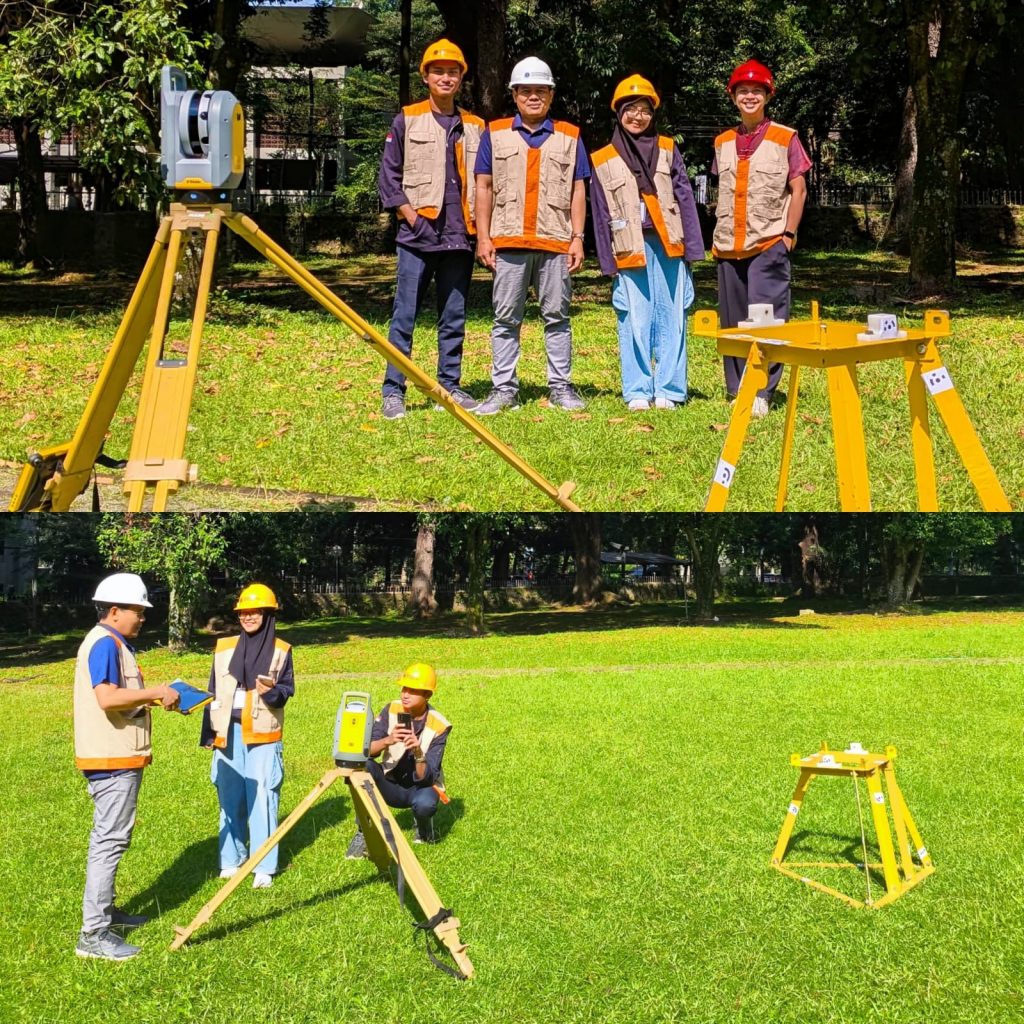
(Left) Research team involved in this project, from left to right: Dwi Hadi Nugraha (Master’s Student in Geodesy and Geomatics Engineering at ITB), Zaeini (Senior Surveyor at PT GPS Land Indosolution), Mentari K. Azzahra (Master’s Student in Geodesy and Geomatics Engineering at ITB), and Gabriella Alodia, Ph.D. (Supervising lecturer from ITB). This collaboration between academics and industry practitioners demonstrates the importance of cross-sector cooperation in developing underwater mapping technology in Indonesia.
(Right) Data acquisition process using Total Laser Scanner (TLS) Trimble X7 in the field. The research team is scanning the ADCP frame to produce an accurate 3D model. This process is conducted from several different positions to ensure data completeness. Although each scan takes only about two minutes, the results obtained are highly detailed point clouds, which will later be compared with underwater scan results.
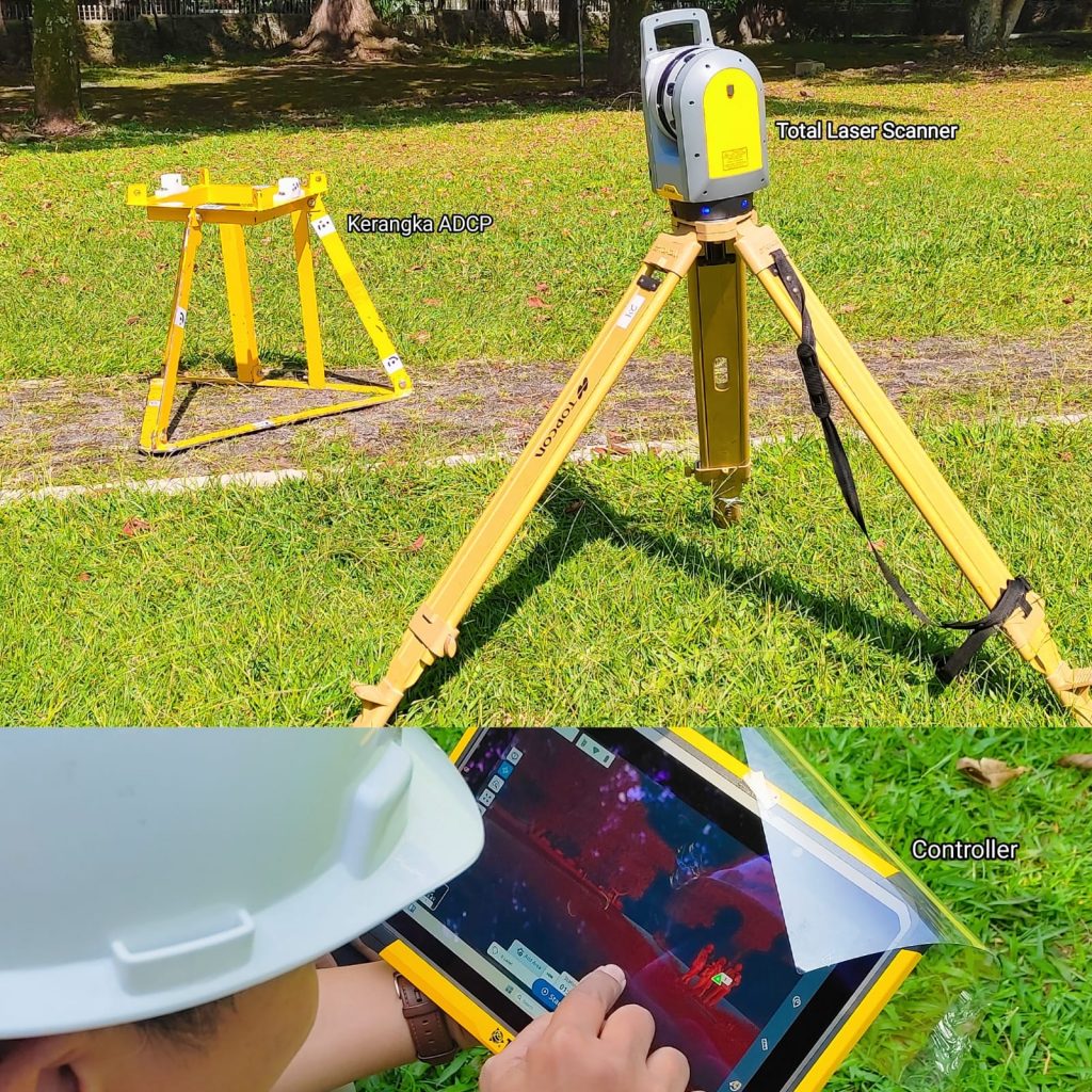
Mr. Zaeni, Senior Surveyor from PT GPS Land Indosolution, directly supervises the data collection activities. The team uses the TLS Trimble X7 device to scan the ADCP frame – a tool that measures ocean current velocity at various depths.
To create a complete 3D model, scanning is done from several positions, not just one point. The ADCP frame is marked with special targets that are easily recognizable by computer programs. These markers help combine data from various positions into one complete model. The result is a highly detailed point cloud, even though each scan takes only about two minutes. After this, the 3D model of the ADCP from the TLS scan will be compared with the results of underwater scanning using Underwater LiDAR and underwater photos taken with the ROV. This activity will be conducted at Panggang Island, Thousand Islands on September 19-28, 2025.
For underwater measurements, the team will use a LiDAR system developed by the Fraunhofer Institute (IPM) which is being tested by researchers from HafenCity University Hamburg. Meanwhile, for capturing underwater photos, they will use a low-cost ROV being developed by the ITB team.
This activity is part of the DEEP-UNDER ROV project (development of photogrammetry to support underwater archaeological studies using remotely operated vehicles) funded by ITB through the 2025 Young Lecturer Research Program. The research, led by Ishak Hilton P. Tnunay from ITB, aims to create a low-cost ROV to examine archaeological objects in Indonesia’s shallow waters. This research also combines various underwater survey techniques to accurately map underwater archaeological sites.
Hits: 8
No Comments